
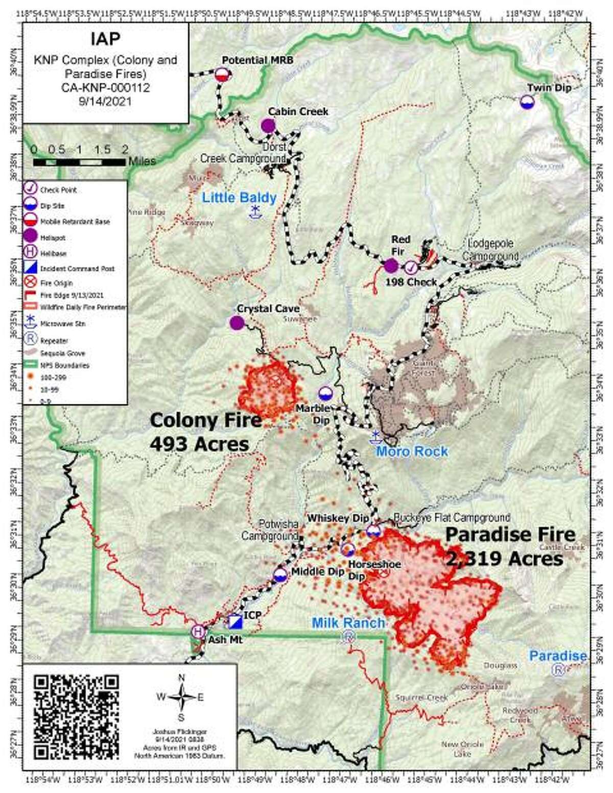
Maps from the U.S. Forest Service show where a pair of wildfires are burning in California’s Sequoia National Park, a popular tourist spot that’s home to some of the world’s largest trees located about 200 miles north of Los Angeles.
The Paradise and Colony fires, named for locations where they started on Thursday, are collectively being called the KNP Complex and have raced through 5,861 acres as of Tuesday evening, with no containment, the U.S. Forest Service said. There was a third blaze, the Cabin Fire, that has been extinguished.
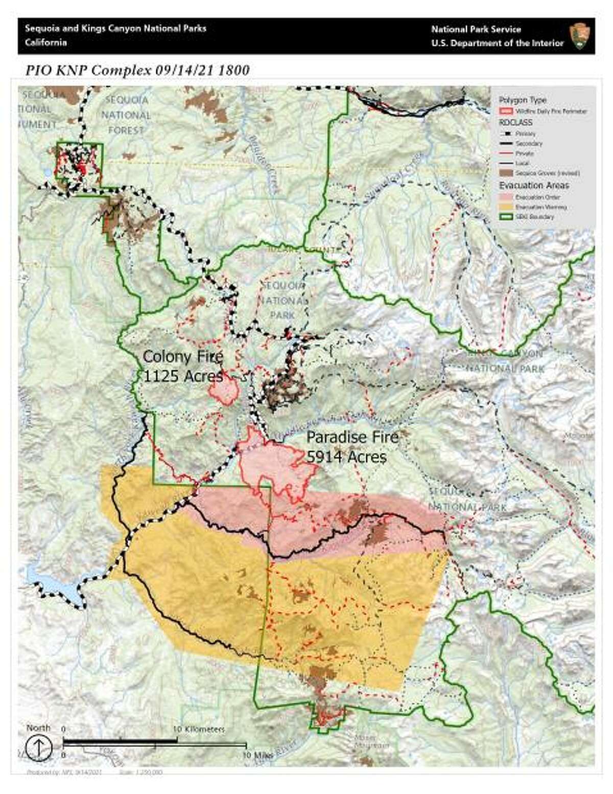
The U.S. Forest Service posted maps showing where the Paradise and Colony fires, collectively being called the KNP Complex, are burning in Sequoia National Park. Map is current as of Sept. 14, 2021.
US Forest Service
Three Rivers, east of the intersection of Highway 198 and North Fork Road, was put under an evacuation warning on Monday and later ordered to evacuate. Only a year ago, the community that serves as a gateway to the parks was evacuated due to the Castle Fire.
Both fires were projected to advance in the direction of Giant Forest, home to more than 2,000 giant sequoias including the General Sherman Tree, which is the largest tree on Earth by volume.
The massive sequoias grow on the western slope of the Sierra Nevada. The General Sherman Tree stands 275 feet (83.8 meters) and is over 36 feet (11 meters) in diameter at the base, according to the U.S. National Park Service.
“There’s no imminent threat to Giant Forest but that is a potential,” Mark Ruggiero, fire information officer for Sequoia and Kings Canyon national parks, said Tuesday.
Ruggiero estimated that the closest flames were about a mile (1.6 kilometers) from the grove. Sequoia headquarters personnel, about 75 people, were being evacuated, he said.
The U.S. Forest Service posted maps showing where the Paradise and Colony fires, collectively being called the KNP Complex, are burning in Sequoia National Park. Map is current as of Sept. 14, 2021.
US Forest Service
On Saturday, Sequoia National Park closed its Tulare County entrance and on Sunday the Giant Forest was shuttered.
Kings Canyon National Park, to the north of Sequoia, remained open.
The potential threat to the giant sequoias came just a year after a disastrous complex of fires in the same region.
Part of the wildfire complex known as the Castle Fire destroyed 10% of the population of sequoias, Ruggiero said.
Sequoias rely on fire for such processes as releasing seeds from cones and making clearings in the forest that allow seedlings to grow. The record of burns in the rings of trees thousands of years old demonstrates their relationship to fire.
But changing climate has intensified forest fires and their impact.
“Sequoia trees are a fire-adaptive tree,” Ruggiero said. “It’s important to have fire to have sequoias thrive, but when we get such intense fires even the sequoias can’t stand up to them.”
Giant sequoias are closely related to the towering, slender redwoods that grow along the Northern California coast and have the same relationship with fire.
The Associated Press contributed to this story.